By Sarah Romer, Wildlife and Conservation Biology BS ‘23, Digital Initiatives Assistant
During my tenure at the Library Archives and Special Collections Digital Initiatives unit, I have spent most of my time working with William E. Peters via the manuscript collection he donated to Ohio University.
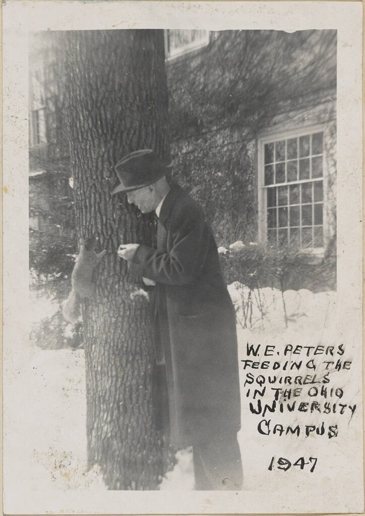
Peters and I are a good team. His eye for detail is unmatched and he excels at making connections with others, while I’m good at putting all the details together and managing the long-term goals. He may have died in 1952, but I’ve had far worse partners for group projects. Peters’ passion and dedication shine through the decades and I’ve loved helping to carry on his torch.
Peters was an engineer, attorney, surveyor, genealogist, and local historian during his lifetime. His passion project was compiling 26 scrapbook volumes, called the Range Books, composed of photographs depicting features within Athens County. Peters was dedicated to ensuring that these features were documented before they were forgotten in the changing landscape of the early to mid 1900s. These features included family cemeteries, schoolhouses, churches, geological features, and a variety of other points of interest. Peters also created hand-drawn maps of every township in Athens County with markers denoting the location of each photo he took.
When I entered the project, I was tasked with helping locate these features in a digital format. The end goal? An interactive web map that would allow community members to engage directly with the history and geography of Athens County. For a full overview of W.E. Peters, the Range Books, and the interactive map, please check out https://bit.ly/peters-athens-storymap.
Once introduced to the project, I could not stay away. My biology background helped me approach the project as a researcher. Data collection I could do. I spent the next year scanning Google Maps and taking strolls down Google Street View. I read reminiscent Facebook posts, found oddly specific Pinterest boards, and enjoyed a random blog post here and there. I gained a deep respect for the reliable entries on Find a Grave, which has records for 104 cemeteries in Athens County. Peters, continually overachieving as the best group partner, found 240.
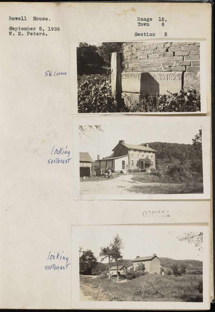
I’ll walk you through the process of mapping a feature. Through features such as the Rowell House, I learned early on to pay attention to detail.
We begin with Peters’ photographs.
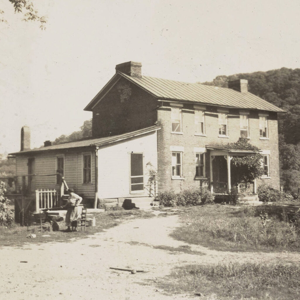
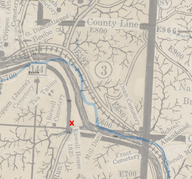
I then reference Peters’ hand drawn township maps that have been superimposed over a single, modern digital map. I locate Range 12, Town 6, Section 3.
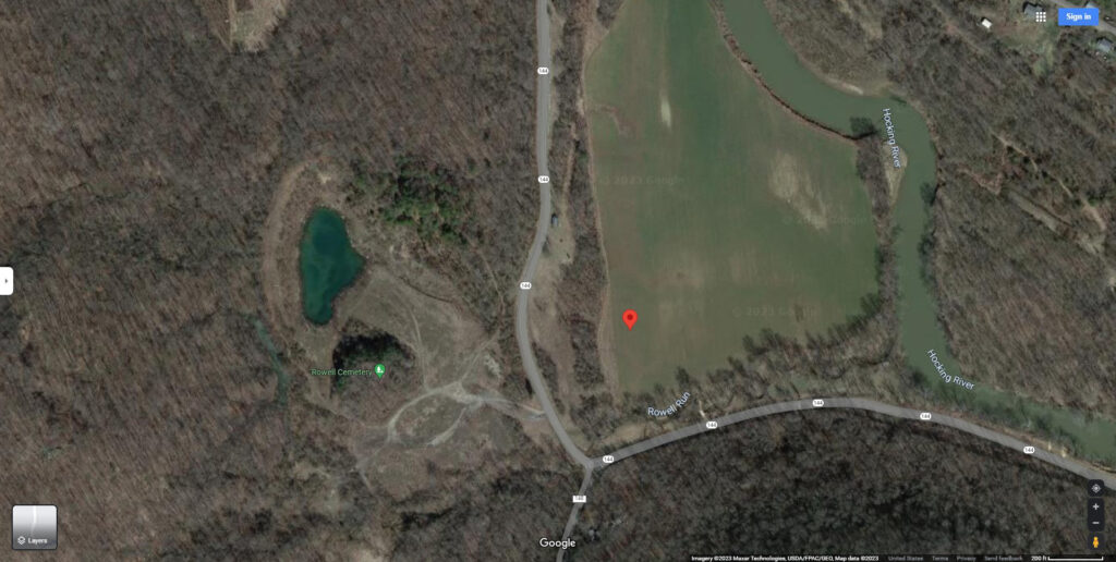
I pull the coordinates from the map and paste them into Google Maps.
Hmmm, the coordinates must be a bit off – I don’t think the house was that far from the road. I see a shed off to the right of OH-144, but that’s not it. It looks like the Rowell House is gone. There is one more thing to try…
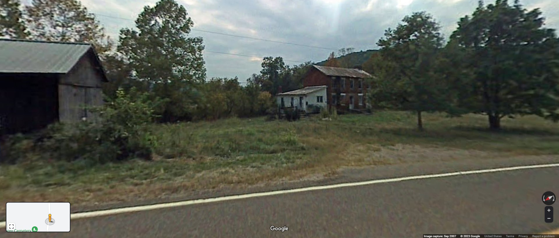
Zooming down the road on Google Street View reveals the Rowell House was still around in 2007, in all its pixelated glory.
The Rowell House reminds us to pay attention. Just because it was around to see both the Civil War and the Google Street View car, does not mean it was exempt from the test of time. I enjoyed finding this unintentional aid to our project and I utilized Street View far more often afterwards.
Without ever leaving my computer, I saw the changes in Athens County through time and space. If you look closely at the background of many photos, you will see sweeping agricultural fields and pastures no longer present. Today, the blanket of rolling green hills that hold OHIO’s bricks are second-growth forests. Regrowth was a result of the rise in Western agriculture, better transportation technologies, and a population exodus as the coal economy faded.
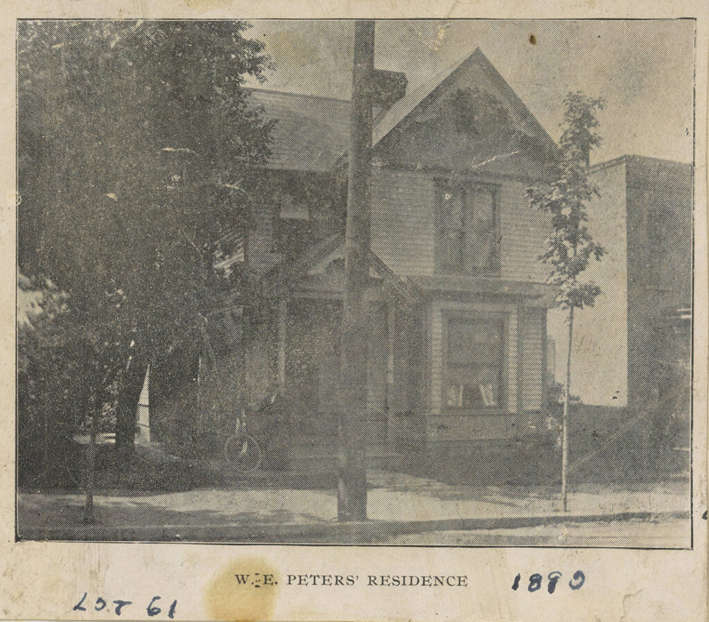
If we are talking themes of change and growth, one of my favorite examples is W.E. Peters’ own home in Athens. This location should look familiar to Athens residents soon, if not yet.
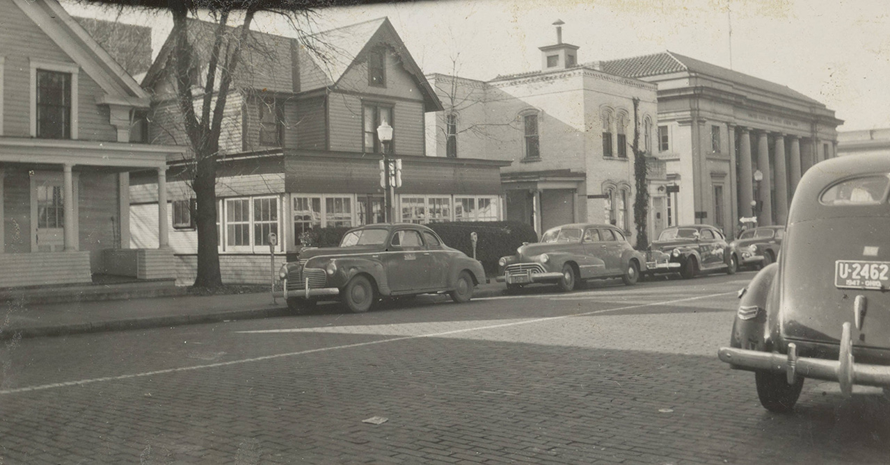
57 years later, Peters photographed the home again. Here, cars line the street, and an addition has been added to the front of the house. Recognize anything yet?
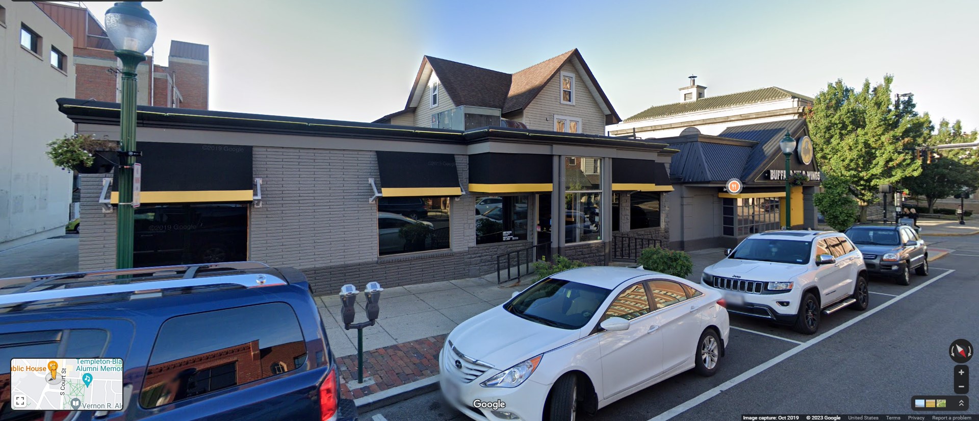
Our friend, Google Street View, reveals that same old story, “House of Local Documentarian Consumed by Buffalo Wild Wings.” You know how it goes.
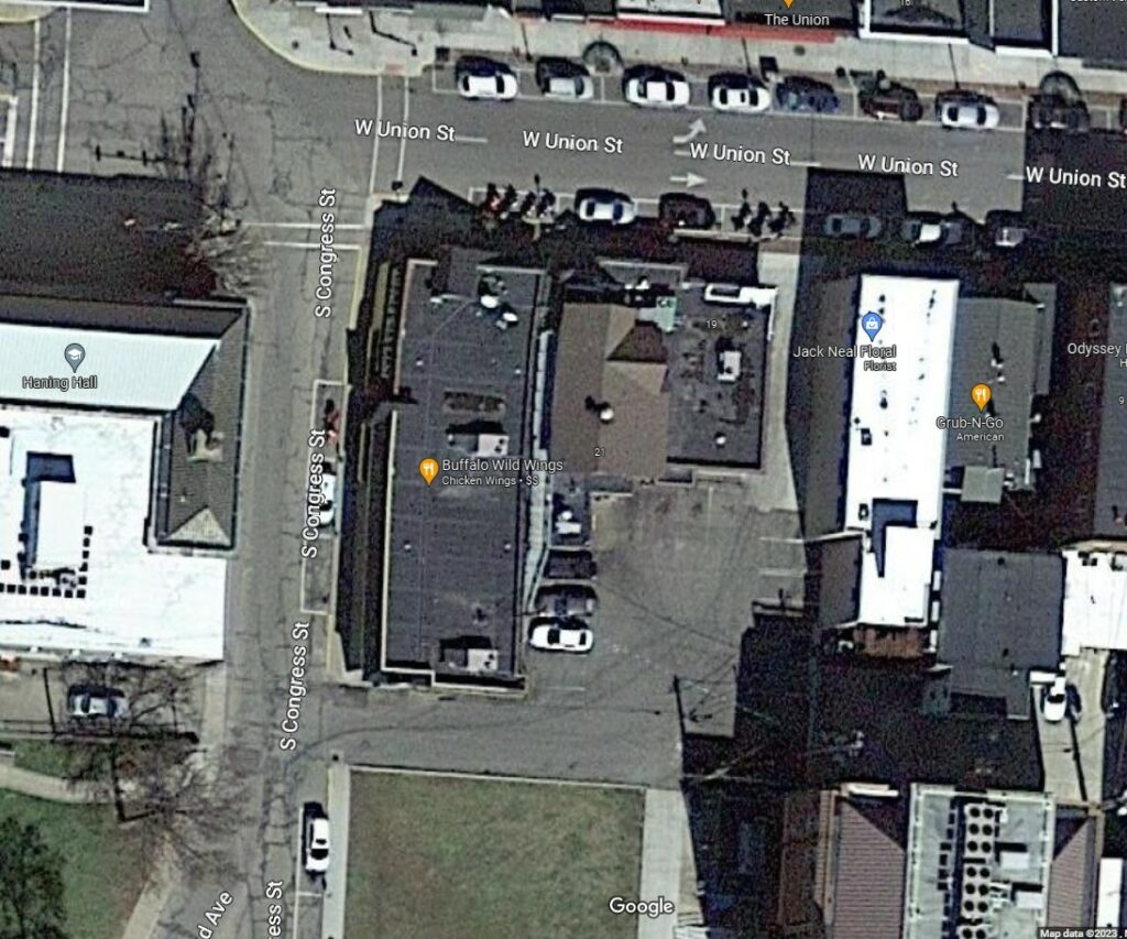
But seriously, consumed entirely.
Look at the roof of the old home trapped in there.
Peters’ own home is a prime example of how places can change over time. It could not have been planned, but I’m nevertheless suspicious. Though his house left clues for me to find, there are many other features that I could not locate. I now hand off the torch to the people of Athens County, students and residents alike, to add to this living record. This whole project is an extension of what Peters began all those years ago. How exciting is it that all the hours I’ve put in result in only the beginning? I cannot wait to see the foundation we built grow and change in the hands of the community. Perhaps others will also be inspired by W.E. Peters, and new features will be documented, and little histories remembered.
Peters and I hope you enjoy.